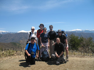
Location: Asuke, close to the tallest mountain in Aichi with access to the Tokai Nature Trail
Number of members: 25
Weather: Gorgeous!
Here are Sergio's photos - feel free to add your own by posting a "comment".
Monday, April 30, 2007
Sunday, April 29, 2007
Sunday, April 22, 2007
Mt. Tsugao hike (273m)
Mt. Tsugao (273m) - Saturday 21st April
Height: 273m
Hiking time: 5 hours
Grade: 0,5 star (easy)
Weather: Cloudy
Description: Inuyama area is really quite nice if you want to get out and do some easy day-hike combined with sightseeings. We took our time to stop and look at all the pretty scenery, visited Inuyama castle and Jakkoin complex temple. It was a very pleasant walking.
Number of hikers: 11
Transportation and cost: Meitetsu express train to Inuyama Sta. at 12:00 (540 yen). From the end of the hike at Zenjino Sta. we made the 5:56 train (650 yen) to Nagoya Sta.
Leader: Sergio
Enjoy the pics. at: http://picasaweb.google.com/sergioinjapan/MtTsugaoHike273m
Wednesday, April 18, 2007
Mt Nyudogatake (906m)
Mt. Nyudogatake (906m) - Sunday 15th April
Sergio's photos
| Height: | 906m |
| Hiking time: | Just under 5 hours |
| Grade | 1.5 star (intermediate) |
| Description | Mt. Nyudogatake is in the Suzuka range in Mie. It is a steep, challenging hike with beautiful views. The hikers also saw nice flowers and visited Tsubaki shrine. |
| Weather | Good |
| Number of hikers | 4 |
| Transportation and cost: | Kintetsu train for Yokkaichi (610 yen each way) at 8.01 arrives 8.34. From Yokkaichi we took a taxi to the start of the hike as the buses are very infrequent. |
| Leaders | David / Sergio |
Sergio's photos
Sunday, April 8, 2007
Kamagatake, 1161m
Mountain: Kamagatake, Suzuka range
Prefecture: Mie/shiga
Height: 1161m
Hikers: 12
Weather: A perfect sunny day
Transportation: 7.52 Meitetsu bus to Yunoyama Onsen (1 hour)
Highlights: views, snacks, waterfalls, river, azaleas and tsubaki flowers, chain work going down steep, slippery slopes - great fun.
Pictures here
Hikers - feel free to reply to this blog with your own photo links or comments
Subscribe to:
Comments (Atom)

